
Turkey’s “Blue Homeland” doctrine has appeared for years in speeches, naval exercises, strategic writing, and official imagery. Now Ankara appears to be moving it into law.
A statute would give the doctrine a different kind of staying power.
According to Hürriyet Daily News, Turkey is preparing legislation to formally define its maritime jurisdiction areas. The proposal was introduced at a news conference hosted by Ankara University’s National Center for the Sea and Maritime Law, known as DEHUKAM, and would reportedly authorize President Recep Tayyip Erdogan to declare certain bodies of water as areas with “special status.” The same report said the bill aims to establish legal definitions for maritime borders, jurisdiction zones, and the activities carried out within them.
That report is the foundation for much of what follows, and it still deserves caution. The full text has not been released, and the bill has not yet reached parliament. It was presented on May 12 at the DEHUKAM news conference, and its drafters expect it to go before the Grand National Assembly after the Eid al-Adha holiday. They frame it as a codification of existing arguments rather than a new set of claims, and the early picture is more restrained than the “Blue Homeland law” label suggests.
According to independent journalist Murat Yetkin, citing a drafter, the draft neither carries the phrase “Blue Homeland” in its title or text, nor includes maps, nor covers the disputed “gray zones,” a reading echoed by leaked details reported in Greek City Times.
The direction, though, is clear enough. The doctrine motivates the law even where the text is drafted to look defensible, and Ankara is moving Blue Homeland from rhetoric toward statute.
“Blue Homeland,” or Mavi Vatan, is not a new phrase. The doctrine grew out of Turkish naval and strategic circles before entering the broader language of the Turkish state. A 2021 study by the French Institute of International Relations described it as an ambitious legal and geopolitical doctrine built around Turkey’s claim to a vast maritime domain, developed by Turkish naval admirals, influential across military, political, economic, and intellectual elites, and adopted by Erdogan in a way that helped consolidate nationalist alliances and provided a legal frame for Turkish action in Libya.
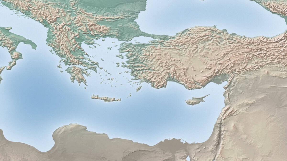
Blue Homeland is bigger than energy, and bigger than Greece. It is a way of imagining Turkey as a maritime power across the Black Sea, the Aegean, the Eastern Mediterranean, Cyprus, and Libya. It links naval modernization, domestic nationalism, Turkish Cypriot claims, offshore resources, migration routes, submarine cables, and a long-standing conviction in Ankara that Turkey is being hemmed in by islands, treaties, and regional partnerships that favor Greece and Cyprus.
To understand why these disputes never resolve, it helps to start with a fact the louder commentary often skips: Turkey is not a party to the United Nations Convention on the Law of the Sea. Greece is. That single difference shapes much of the dispute. Greece argues from the convention; Turkey argues from its own reading of customary law and rejects the parts of UNCLOS it considers unsettled. The two sides are not simply disagreeing about who is right under a shared rulebook. They do not fully agree on the rulebook.
Some of Turkey’s positions are not fringe, even where Greece and most of its partners reject them. Under Article 121 of UNCLOS, islands generally generate the same maritime zones as other land territory. The narrower entitlement fight is over Article 121(3), which says that rocks unable to sustain human habitation or economic life of their own do not generate an exclusive economic zone or continental shelf. That is one reason small and isolated features, including Kastellorizo in the Eastern Mediterranean debate, carry such legal and political weight.
The second question is delimitation: how much effect islands should receive when overlapping continental shelf or exclusive economic zone claims are drawn between states. International courts and tribunals have sometimes reduced the effect of small or isolated islands when seeking an equitable result. None of that makes Turkey’s maximal claims correct. It does mean a fair account should treat the legal terrain as disputed, rather than as a mechanical exercise in drawing a median line.
For Greece, the Aegean matters most.
Turkey treats the Aegean as a semi-enclosed sea between the Turkish and Greek mainlands, crowded with thousands of islands, islets, and rocks. The Turkish Foreign Ministry says both countries currently exercise six nautical miles of territorial waters there, and that any Greek extension beyond six miles would be unacceptable. Ankara argues that a Greek move to 12 nautical miles would turn the Aegean into what it calls a “Greek Sea,” restrict Turkey’s access to the high seas, and affect military, economic, navigational, scientific, and fishing activity.
This is not purely hypothetical. Greece extended its territorial waters to 12 nautical miles in the Ionian Sea in 2021, on its western flank, where Turkey is not a neighbor, while explicitly reserving the same right elsewhere. The Aegean remains at six miles. Greece maintains that its islands carry full maritime rights under international law and that any delimitation should follow the equidistance, or median line, principle. It sees Turkey as trying to shrink or erase the legal effect of those islands.
The Hellenic Republic Ministry of Foreign Affairs describes the delimitation of the continental shelf and exclusive economic zone as the only legal dispute Greece recognizes with Turkey in the Aegean. Athens has not exercised that right in the Aegean, where Turkey has warned that such a move would be treated as a casus belli, a cause for war, but it has demonstrated that the right is real to it.
The dispute can sound technical; its consequences are concrete. It governs where states can authorize energy exploration, where cables and pipelines may pass, where marine parks can be declared, where fishing can be regulated, and where naval or research vessels may operate.
A Turkish domestic law would not settle any of that. Turkey cannot, by passing its own statute, bind Greece, Cyprus, Egypt, or Libya. It cannot erase the maritime rights Greece claims for its islands. It cannot make the Turkey-Libya maritime memorandum binding on Athens, and it cannot resolve the Cyprus problem.
Its effect would be more practical: it could guide permits, licensing, marine planning, official objections, research permissions, and energy claims, and shape how Turkish agencies speak about disputed waters. It could make a far-reaching claim easier to administer and harder to walk back.
That is where a statute becomes more consequential than another map.
The same logic runs through maritime spatial planning. In June 2025, Reuters reported that Greece protested a Turkish maritime spatial plan, saying it claimed areas under Greek jurisdiction and lacked legal basis. The Turkish map, prepared as academic work by Ankara University and submitted to UNESCO’s Intergovernmental Oceanographic Commission, outlined zones for fishing, shipping, tourism, energy, research, and military use.
Greece had earlier filed its own maritime spatial plan with the European Union after years of delay. Reuters reported that Athens said its plan did not define exclusive economic zones, which are established through bilateral agreements, and attributed the delay partly to its long coastline, numerous islands, and the geopolitics of the Eastern Mediterranean.
Both states are now using planning documents in an unresolved maritime space, though not from the same legal position. Greece filed its plan under EU obligations. Turkey’s plan, in Athens’s view, uses the language of planning to project claims Greece rejects. The fight is over whose map becomes the baseline. Marine spatial planning sounds bureaucratic; in disputed waters, that is precisely its power.
The Eastern Mediterranean raises the stakes further. The 2019 Turkey-Libya maritime agreement drew a line across the region that Greece rejects because it disregards Greek islands, including Crete. In July 2025, Reuters reported that Greece invited Libya’s internationally recognized government in Tripoli to begin talks on maritime zones, seeking to repair ties strained by the Turkish-Libyan deal, and noted that Greece’s hydrocarbon tender off Crete had drawn Libyan objections.
This is the wider geography behind the doctrine: not just the Aegean but Crete, Kastellorizo, Cyprus, and Libya, and the recurring question of whether islands interrupt Turkey’s preferred lines across the sea.
Cyprus makes the issue even more combustible, because Turkey does not recognize the Republic of Cyprus as the sole legitimate authority on the island. Maritime claims around Cyprus are therefore about more than energy blocks or drilling ships. Every offshore license, drilling claim, map, and naval warning folds into a larger contest over recognition, sovereignty, and who may speak for the island.
The European Union already has a sanctions framework tied to Turkey’s unauthorized drilling activities in the Eastern Mediterranean. In December 2025, the Council of the EU said the restrictive measures had been extended to November 30, 2026, but with no one currently listed. The instrument exists; Brussels is keeping it ready rather than using it.
That suggests the likely European pattern. The EU may object politically to Turkish codification, especially since Greece and Cyprus are member states, but it is more likely to act if Ankara turns legal language into concrete moves: drilling, licensing, naval escorting, interference with research, or enforcement in waters Greece claims. Implementation will matter more than declaration.
There is one further dimension, and it should be offered as a possibility rather than a proven strategy: the dispute may be seeping into how Turkey teaches its own students.
In remarks reported by T24, Turkish Education Minister Yusuf Tekin criticized the curriculum’s use of “Ege Denizi,” the Turkish name for the Aegean Sea. He argued that at the time of the Treaty of Lausanne the sea was called “Adalar Denizi,” or “Sea of Islands,” and that “Aegean Sea” entered the literature after the Second World War with some Greek influence. The objection sat inside a wider nationalist revision of curricular language that, he said, shapes national consciousness and state loyalty.
It would be a stretch to call this, on its own, a campaign to teach Blue Homeland. The doctrine itself was not invoked, and the only public echo so far is a single sympathetic column in Yeni Akit repeating the call to replace “Ege Denizi” with “Adalar Denizi.” That shows the idea has readers, not that it is policy.
Still, the link is not far-fetched. Turkey’s maritime case depends on minimizing how much Greek islands count, and teaching the sea as the “Sea of Islands” pushes the mental geography toward exactly that framing: islands as the defining feature, their status open. Naming is not law, but it shapes the worldview in which future claims will be heard.
Turkey’s Blue Homeland push is therefore best read as a campaign on two clear fronts, legal codification and maritime planning, with a possible third in national narrative. The law would matter because it could turn doctrine into authority. The planning matters because it turns claims into maps and uses. The educational language, if it grows beyond a few speeches, could make those claims feel natural to the next generation.
None of these rewrites international law. A Turkish statute binds no one abroad; a renamed sea in a textbook moves no boundary; a plan filed in Paris settles nothing on its own.
But they normalize. They move an argument from speeches into documents, from documents into administration, and potentially into public memory. Over time that can make compromise harder, not because the law of the sea has changed but because domestic politics has.
For Greece and Cyprus, the task is to respond firmly without overstating what Turkey can legally accomplish, and without pretending the underlying law is as one-sided as advocacy sometimes implies. The near-term danger is an incident at sea, which is always possible. The deeper concern is administrative hardening: disputed claims becoming embedded through laws, permits, planning maps, and diplomatic filings on both sides.
For the European Union, the file is awkward. Greece and Cyprus are members; Turkey is a NATO ally and a major power with leverage over migration, security, trade, and energy. Brussels often prefers stability with Ankara, and the Blue Homeland question tests whether it treats Greece and Cyprus as front-line European states or as bilateral problems to manage quietly.
For NATO, the problem is narrower but real. Greece and Turkey are allies in the same alliance. NATO can reduce risk and keep channels open; it cannot adjudicate sovereignty, continental shelf, island rights, or boundaries. The core dispute sits outside its comfort zone.
For Greek Americans and other observers in Washington, the question that matters is not whether Greece and Turkey have another tense summer. It is whether the rules-based vocabulary that smaller and middle-sized states rely on can hold when a stronger neighbor works to turn unresolved claims into permanent state practice, and whether the response stays anchored to that same vocabulary rather than mirroring the maximalism it criticizes.
The things to watch are specific. When the bill reaches the Grand National Assembly, does the submitted text keep the restraint of the early draft, or does it add the maps and “gray zones” the drafters say are absent? Does it name “special status” waters, link to the Turkey-Libya memorandum or Turkish Cypriot claims, or create new licensing, planning, or enforcement powers? Does Turkey use it to press harder against Greek energy exploration, research, or marine activity? Those details will reveal whether the law is declaratory or operational.
For now, the larger meaning is already visible. Turkey is doing more than arguing over boundary lines. It is building a legal and institutional structure around its view of the sea.
Greece and Cyprus are resisting because they understand what such a structure could become. Their strongest response will be one that stays anchored in law, evidence, and international legitimacy, rather than simply matching the volume of the doctrine it opposes.